
Solutions made for SAR professionals, by SAR professionals.
Purpose-built digital tools to coordinate, communicate, and save lives, faster.
Drift Prediction Platform
SAR DRIFT
Maritime drift simulation for search and rescue.
- 85drift objects from the leeway catalogue
- 3000trajectories per simulation
- 7interface languages

The Problem It Solves
Faced with a person in the water, a vessel in distress or a lost object, every minute counts. Rescue coordinators must decide where to search, fast, while currents, wind and waves constantly move the target.
What SAR DRIFT Enables You to Do
SAR DRIFT is an operational maritime drift-forecasting platform. It computes probable search areas in real time to guide coordinators' decisions. The engine relies on a Lagrangian Monte-Carlo simulation: thousands of virtual particles are propagated by currents, wind and waves to produce a reliable drift envelope and an optimised search area in seconds.
Key Features
- Allen and Plourde leeway parameters for more than 80 object categories (persons, life rafts, vessels, debris, containers)
- Runge-Kutta 2 advection on Copernicus Marine current data
- Stokes drift computed from wave spectra
- Okubo turbulent diffusion and high-resolution land mask
- Interactive map interface with chronological playback
- Real-time environmental data (Copernicus Marine, Open-Meteo)
- Seven languages, multi-organisation access, and an administration console
- Deployed and operational, accessible from a simple web browser
Why We Built It
Beyond rescue, the same drift engine naturally extends to other maritime challenges: pollution response, biodiversity monitoring in marine protected areas, offshore wind-farm surveillance and macro-waste tracking. One core, many applications. SAR DRIFT: predict the drift, optimise the search, save lives.
Pricing
From €2,900/year (excl. VAT).
Operational Command Platform
SARCHAT
The operational command platform for Search & Rescue.
- 9interface languages

The Problem It Solves
During SAR operations, communication between actors is scattered: emails, phone calls, WhatsApp groups. Critical data is siloed, vessel positions in one system, satellite imagery in another, weather in a third. This fragmentation costs time, and in SAR, time costs lives.
What SARCHAT Enables You to Do
SARCHAT unifies communications, situational awareness and operational planning in a single secure platform, with real time mapping, automatic translation, and AI assisted reporting.
Key Features
- End to end encrypted messaging (AES) with automatic translation (9 languages)
- Role based access and multi level coordination: local, national, international
- Operation classification (ALERFA, DETRESFA, OP SAR) with automatic numbering
- Interactive mapping with 4 base layers (OSM, topographic, satellite, maritime) and real time synced drawing tools
- GPX/KML import & export, live position sharing with video streaming
- Copernicus satellite imagery (Sentinel-1 SAR & Sentinel-2 optical) with freshness filtering and georeferenced overlay
- Real time AIS vessel tracking and ADS-B aircraft tracking with dual source data fusion
- SAR search pattern generator: Parallel Sweep, Creeping Line Ahead, Expanding Square, Sector Search, with KML export
- Operational calculators: glide cone (60+ aircraft), drift estimation, azimuth & distance, CPA/TCPA, DVT solver
- Land & marine weather: wind, visibility, wave height, swell, sea temperature, ephemeris
- AI-powered SITREP generation with smart message filtering and automatic data integration
- PDF/CSV reporting, integrated address book, and bulk alert notifications
Why We Built It
Too much vital information was getting lost in the noise. SARCHAT was designed with one goal: give SAR coordinators a single operational picture, communications, mapping, tracking, and intelligence, so they can focus on what matters: saving lives.
Pricing
From €7,200/year (excl. VAT) or €600/month (excl. VAT) for 20 users.
Cospas Sarsat Management System
CLEAR 406
Decode distress signals instantly. Know who should act, in seconds.
- 100 %of messages interpreted correctly, measured on 209 real messages
- 9interface languages

The Problem It Solves
Analyzing SIT 185 messages is time consuming, error prone, and requires technical expertise. Many RCCs still handle these alerts manually, slowing down response times.
What CLEAR 406 Enables You to Do
CLEAR 406 automates the decoding of COSPAS-SARSAT distress messages and instantly displays the position and responsible authority on an interactive map.
Key Features
- Automatic decoding of SIT 185 messages
- Display of location, uncertainty radius, and associated zones
- Immediate identification of the responsible SAR authority
- Links to vessel databases (MMSI, HEX ID), weather, and AirSAR/SeaSAR tools
Why We Built It
As operators, we used to waste 10 to 15 minutes just figuring out who should act. With CLEAR 406, we wanted an instant, intuitive tool that reduces delays from the very first seconds of an alert.
Pricing
Available in a free version with essential features. Premium version: €4,900/year (excl. VAT). Custom versions available for national RCCs.
Coastal Navigation App
NAVLITE
Navigate the coast with confidence.
- 6interface languages

The Problem It Solves
On the water, recreational mariners need to know exactly where they are, where they are heading and how fast, and to keep watch when at anchor, often far from any mobile network. Consumer maps are not built for the sea, and dedicated chartplotters are expensive and stay on board.
What NAVLITE Enables You to Do
Designed for boaters, sailors and kayakers, NavLite shows your position, heading and speed on a clear, fast and beautiful marine chart. Plan routes, record tracks, keep an anchor watch and find your way back to a man overboard, online or completely offline.
Key Features
- High-definition OpenStreetMap vector chart, an OpenSeaMap layer for buoys, lights, beacons and harbours, and a Sentinel-2 satellite view
- Real-time GPS position with course over ground (COG) and speed over ground (SOG)
- Route planning with waypoints, track recording, points of interest, and distance and bearing measurement
- Anchor watch alarm: set a virtual anchor and radius, and NavLite alerts you on drift, even with the phone locked
- Man Overboard mode: mark a position with one tap and navigate back with bearing, distance and elapsed time
- Full offline navigation: download your area, chart and marks, and sail with no network at all
- Day and night modes to preserve night vision; your data stays on your device
Why We Built It
At Global SAR Hub, safety at sea is our reason for being. We built NavLite to give every recreational mariner a clear, reliable companion that always answers one question: where am I, and where am I heading?
Pricing
Free on the App Store and Google Play. Premium removes all advertising.
Maritime Safety Companion App
CH16
Maritime safety in your pocket. For every seafarer.
- 350+rescue centres in the app
- 6interface languages
The Problem It Solves
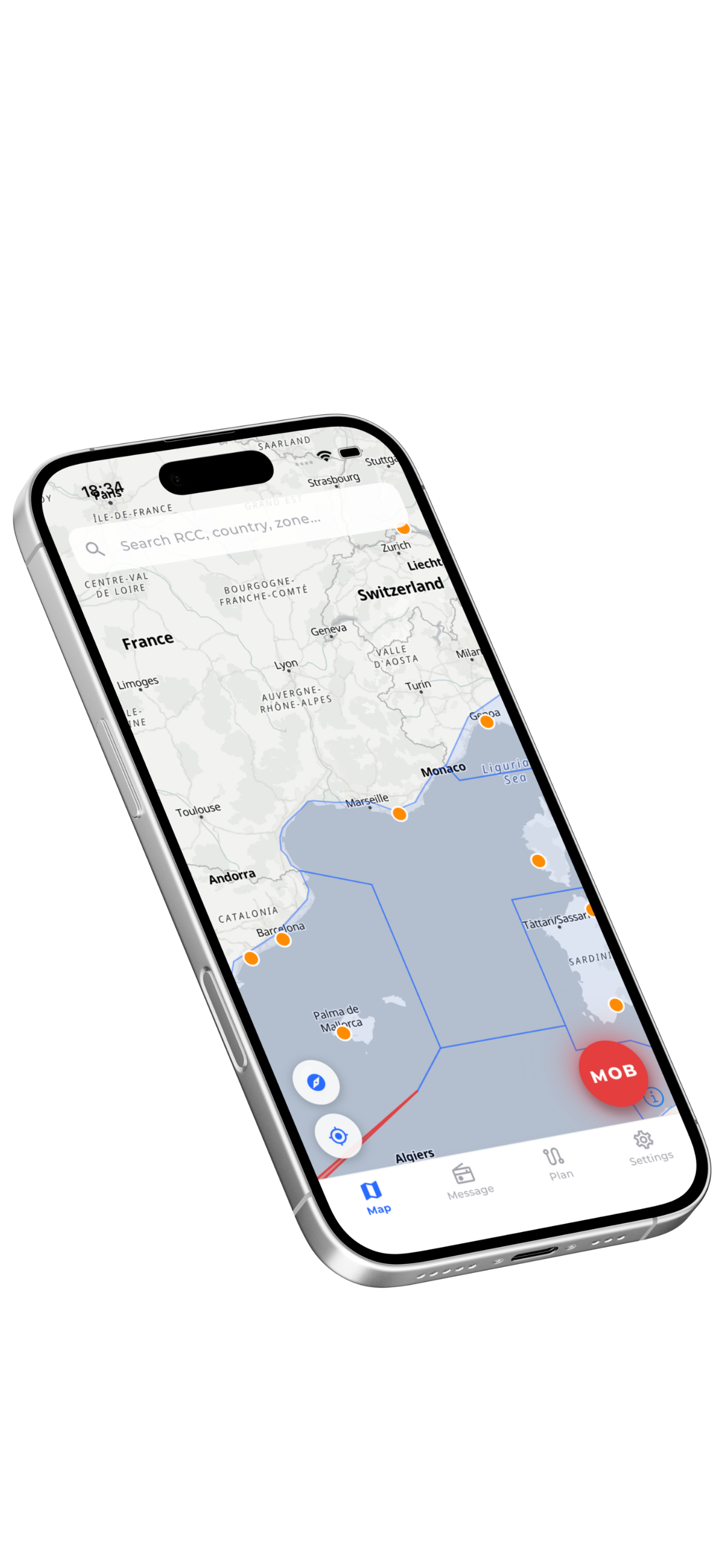
At sea, when seconds matter, knowing who to call, and how, can save lives. Mariners often lack immediate access to the right Maritime Rescue Coordination Center, up to date distress procedures, or a reliable way to generate a fully compliant MAYDAY message.
What CH16 Enables You to Do
Built alongside rescue professionals, mariners and pleasure sailors, CH16 puts every tool a seafarer may need in a single offline ready app: instant access to the right rescue center, distress message generation, Man Overboard tracking and passage planning.
Key Features
- Instant access to more than 350 Maritime Rescue Coordination Centers (MRCC, MRSC, JRCC) worldwide
- Interactive Search and Rescue Region (SRR) map with real time zone detection
- MAYDAY and PAN PAN message generator, fully compliant with IMO and GMDSS, with audio playback
- Man Overboard mode with GPS tracking and DMD positioning
- Passage Plan: declare your route and automatically notify every rescue center along the way, in their own language
- Smart notifications when crossing into a new SRR zone
- Six languages supported, fully functional offline
Why We Built It
Because at sea, knowing who to call, and how, can save lives. CH16 was designed with rescue professionals and mariners to put the right information in every seafarer's pocket: commercial captains, rescue coordinators, fishermen or weekend sailors.
Pricing
Free on the App Store and on Google Play.
Search & Rescue Unit Management System
SRU MANAGER
Real time visibility into every rescue unit, from a single dashboard.
- 3interface languages
The Problem It Solves
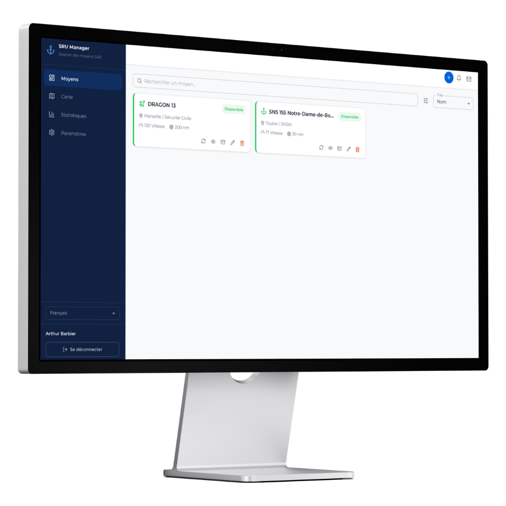
During SAR operations, RCCs (Rescue Coordination Centres) struggle to maintain an accurate, real time picture of available rescue assets. Status updates rely on phone calls, emails, or outdated spreadsheets, leading to delayed deployments and poor resource allocation when every minute counts.
What SRU MANAGER Enables You to Do
SRU Manager gives RCCs a single, live dashboard to track every rescue unit availability, location, and capabilities, with direct notification links so SRU operators can update their own status in seconds.
Key Features
- Real time status tracking: available, unavailable, deployed, with automatic expiration and T-30 alerts
- Interactive map with operation mode to identify units within coverage range
- One click notification via email or shareable link (WhatsApp, SMS) for instant status updates
- Per unit statistics: availability rates, deployment counts, time tracking down to the minute
- Multi language support (FR/EN/ES) for international coordination
- Role based access: Super Admin, Admin, Operator, Viewer
- Custom fields and regions to match any organisation structure
Why We Built It
RCCs needed a purpose built tool, not another generic fleet tracker. SRU Manager was designed from the ground up for SAR coordination: simple enough for an SRU operator to update their status from a phone in 10 seconds, powerful enough for an RCC to coordinate dozens of assets across multiple regions in real time.
Pricing
From €3,000/year (excl. VAT). No commitment. Immediate deployment via web browser.
Learning Management System & Operational Memory
GSH ACADEMY
From day one of training to staying current in operations.
The Problem It Solves
In an operational organization, knowledge is everywhere and nowhere: training material sits in a folder, competency tracking in a spreadsheet, visits and drills in another file, and the day's standing orders travel by email. So no one can answer the only question that really matters: who is current, on what, and until when. And on the day of an inspection or an incident, the evidence has to be pieced back together by hand.
What GSH ACADEMY Enables You to Do
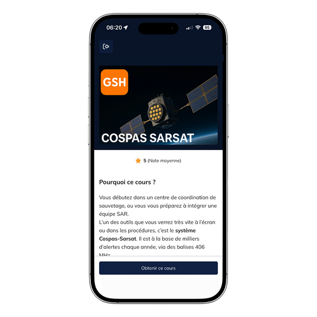
GSH Academy is a complete learning management system that does not stop at the certificate. It carries a competency through its entire life, in three stages.
- Train
- Your newcomers work through interactive courses and progressive pathways, sit their assessments, and leave with a verifiable certificate.
- Maintain
- Visits, drills, placements and duty rosters are logged as they happen. A single screen tells you who is current, on what, and until when.
- Retain
- Your standing orders and lessons learned reach every team, then build into a classified, searchable base that stays open at the operator's position, on watch. This is where training meets operations.
All of it from a standard web browser, on desktop as well as on mobile.
Key Features
- Courses that hold attention: video, audio, annotated imagery, scenario work, points and badges to see it through
- The full assessment chain, from the proctored exam to the certificate, whose authenticity anyone can verify online
- Currency on a single screen: who is qualified, on what, and what is about to expire
- A living operational memory: your orders reach the teams and stay available at the position, on watch
- Accountability at any moment: dashboards, exportable reports, a timestamped record of every action
- A structure that mirrors your own, from a single center to a national organization, with permissions that match the field
- Your courses and procedures migrated by our teams, with your vocabulary and your logo on the platform
Why We Built It
We are SAR operators, and we train SAR operators. We have seen crews taught from material frozen for ten years, competencies tracked in spreadsheets no one opened, and critical standing orders pinned to a wall no one read anymore. No single tool held those three things together: training platforms stop at the certificate, management software ignores the teaching. So we built the one that was missing.
It is open to any organization that trains and operates: you bring your courses, your procedures and your way of working, and our teams install them in the platform. And when the field calls for it, our instructors come and train your people on site.
Pricing
€300/year (excl. VAT) per person in training.
Supervisory, command and administrative accounts are free. Migration of your courses and procedures, on-site instructor training and white-label version: on request.
The international Search and Rescue podcast
MISSION READY
Knowledge saves lives. Short, multilingual episodes for the global SAR community.
The Problem It Solves
Most SAR related content available worldwide is published exclusively in English. For many rescue centers, developing countries, or non English speaking professionals, access to technical information, field experience, and innovation is limited, resulting in uneven sharing of best practices, limited visibility of modern tools, and significant gaps in understanding global SAR systems.
What MISSION READY Enables You to Do
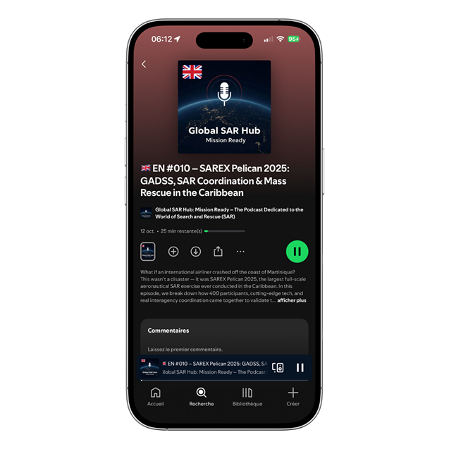
Mission Ready delivers short, clear and structured episodes that explain the systems, technologies, operations and challenges of Search and Rescue, at sea, in the air, or on land. The podcast makes technical subjects accessible in multiple languages, covering satellite rescue systems, maritime and aeronautical coordination, Mass Rescue Operations, technological innovation, international procedures, operational field experience, and SAR tools and their real world use.
Why We Built It
Because knowledge saves lives. Mission Ready was created to widely share reliable, up to date SAR information in multiple languages, with no cost and no access barriers, supporting SAR professionals, sharing real field expertise, spreading best practices, and making innovation accessible to all.
Pricing
Free and accessible to all. Multilingual episodes available online.